Satellites Programme
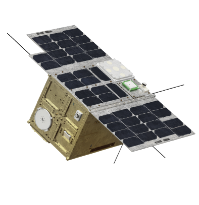
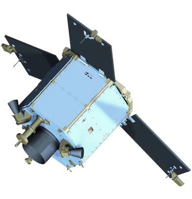
PHI-1 SAT
PHI-1 (Payload Hosting Initiative-1) is a modular satellite platform developed by MBRSC under the Payload Hosting Initiative (PHI) programme in partnership with the United Nations Office for Outer Space Affairs (UNOOSA) initiative ‘Access to Space for All’. The initiative provides a 12U CubeSat platform to host innovative payloads and emerging space technologies from around the world, promoting international collaboration and capacity-building in the space sector.
PHI-1 hosted payloads from Bahrain Space Agency and Antarikchya Pratisthan Nepal, which were selected through a competitive process in 2022. The Bahrain Space Agency’s AMAN payload is a technology demonstration that tests Advanced Encryption Standard protocols to enhance satellite communication security, while Antarikchya Pratisthan Nepal’s LoRa Satellite System explores how LoRa communication technology performs in orbit.
Additionally, MBRSC integrated its New-Space Earth observation video camera for technology demonstration. Sharjah Space and Astronomy Hub also contributed a PCB designed to measure temperature and orientation in space, supporting research and educational outreach.
By enabling payload hosting, PHI reduces cost, risk, and development timelines, enabling nations and entities to focus on their space innovations while gaining real-world experience and advancing their capabilities.
Facts & Figures:
Launch Date | 11 November 2025 |
Launch Time | 10:18 PM (UAE Time) |
Launch Vehicle | SpaceX Falcon 9 |
Launch Site | Vandenberg Space Force Base, California, USA |
Orbit | Low Earth Orbit (~500 km altitude) |
Mass | Up to 20 kg |
Dimensions | Approx. 20 × 20 × 30 cm (12U CubeSat configuration) |
Mission:
To open access to space for all by offering an inclusive platform for testing, collaboration, and innovation, enabling new players to contribute to the global space ecosystem.
Objectives
- Foster innovation in the global space technology sector.
- Share knowledge throughout all stages of satellite design, manufacturing, testing, and launch.
- Provide opportunities for countries and institutions to participate in a real space mission.
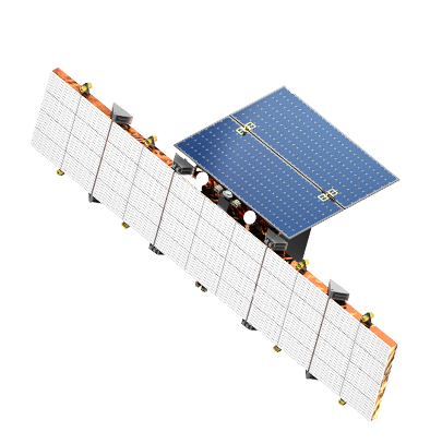
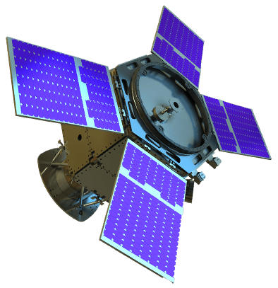
Etihad-SAT
Etihad-SAT is an advanced Earth observation satellite utilising advanced Synthetic Aperture Radar (SAR) technology, delivering high resolution imaging capabilities. The satellite, set to be launched in March 2025 and built in collaboration with Satrec Initiative, is an expansion of MBRSC’s portfolio of satellites and enables enhanced Earth-observation data through radar-based imaging, operating effectively regardless of weather or environmental conditions.
The satellite offers three imaging modes: spot mode (high-resolution imaging for small areas), scan mode (wide-area coverage for large regions) and strip mode (extended observation for longer regions). These features make Etihad-SAT a powerful tool for multiple industries, from detecting oil spills and managing natural disasters to enhancing maritime navigation, supporting smart agriculture, and conducting environmental monitoring. Additionally, the data provided by Etihad-SAT will be processed using AI-powered technologies.
Facts & Figures:
Launch Date: March 2025
Launch Vehicle: Vandenberg Air Force Base, California, USA, via Falcon 9 rocket
Altitude: 500 km (+/- 15 km) (Low Earth Orbit)
Mass: 220 kg
Dimensions: 3.5m x 1m x 1.4m
Mission: Enhance the UAE’s Earth observation capabilities by introducing radar-
based imaging technology, complementing existing optical satellite systems and aid in detecting oil spills, monitoring natural disasters, enhancing maritime navigation, supporting smart agriculture, and conducting environmental monitoring.
MBZ-SAT
MBZ-SAT is the most advanced satellite in the region that provides high-resolution Earth-observation images and data to users worldwide. The satellite, launched on 14 January 2025, provides detailed images for for various applications including environmental monitoring, navigation, infrastructure management, and disaster relief, significantly aiding in the assessment and response to natural calamities. MBZ-SAT has double the image capture accuracy, 4 times faster data transfer speeds and produces 10 times more images, than its predecessor. The satellite is a continuation of the UAE’s broader role in fostering a sustainable, science-driven economy while enhancing the quality of life for people globally through advanced satellite capabilities.
Facts & Figures:
Launch Date: 14 January 2025
Launch Vehicle: Vandenberg Air Force Base, California, USA, via Falcon 9 rocket
Altitude: 500-550 km (Low Earth Orbit SSO)
Mass: 750 kg
Dimensions: 3 m x 5 m
Mission: High-resolution imagery for mapping, environmental monitoring, navigation, infrastructure management, and disaster relief.
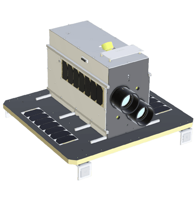
HCT-SAT1
HCT-SAT 1, the Earth observation CubeSat was developed by Higher Colleges of Technology (HCT) students under the expert guidance of MBRSC engineers. The MBRSC team spearheaded a broad range of operations, including assembly and integration to the stringent testing of the satellite as well as overseeing the payload launch and ensuring the seamless provision of all essential communication services. The partnership between MBRSC and HCT also entailed a comprehensive educational experience, empowering both students and faculty members with expert training, and delivering substantial support in the immersive CubeSat curriculum. Collaborative projects such as the development of HCT-SAT 1 aims to integrate space technologies within educational programmes, catalysing a new era of innovation and learning in space science and exploration. The initiative, designed to reach out to a broad spectrum of academic institutions, from universities to local high schools, is seeking to ignite a passion for STEM education among the youth within the UAE. HCT-SAT 1 is slated for launch in January 2025.
Facts & Figures:
Launch Date: No earlier than January 2025
Launch Site: Vandenberg Air Force Base, California, USA, via Falcon 9 rocket
Altitude: 510-590 km (Low Earth Orbit SSO)
Size: 1U
Dimensions: 10 cm x 10 cm x 11.35 cm
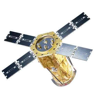
TRACK KHALIFASAT
KHALIFASAT
Launched in October 2018, KhalifaSat is one of the most advanced Earth observation satellites globally and the first 100% designed and manufactured in the UAE. KhalifaSat’s high-quality images support international governments and organisations in environmental monitoring, urban planning, and disaster response. The satellite boasts five patented technologies, underscoring the UAE’s position as a key player in the global space industry.
Facts & Figures:
Launch Date: October 29, 2018
Launch Site: Tanegashima Space Centre, Japan, via H-IIA rocket
Altitude: 613 km (Low Earth orbit)
Mass: 330 kg
Dimensions: 1.5m x 2m
Orbit Duration: 98.1 minutes per orbit
Mission: High-resolution 3D imagery, including 0.7 m panchromatic resolution and 2.98 m in four multispectral bands.
DMSAT-1
DMSat-1 was developed by MBRSC in collaboration with the Dubai Municipality and is the region’s first nanometric environmental satellite, that was launched in March 2021. It features next generation capabilities, deploying the latest techniques to monitor air pollutants and greenhouse gases. DMSat-1 was built in the clean rooms at MBRSC and is providing data essential for the sustainable future of Dubai. The project has also helped develop the technical capabilities of municipality management and environmental specialists.
Facts & Figures:
Launch Date: 22 March 2021
Launch Site: Baikonur Cosmodrome in Kazakhstan, via Soyuz 2.1a rocket
Altitude: 550 km from Earth’s surface
Mass: 15 kg
Turnover Rate: 14 revolutions around the Earth per day
Mission: Map air quality and monitor climate change in the UAE.
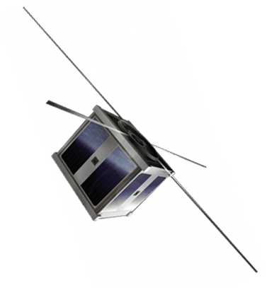
NAYIF-1
Nayif-1, launched in 2017, was the UAE’s first nanosatellite. Developed in collaboration with educational institutions, especially the American University of Sharjah (AUS), the project provided Emirati students with hands-on experience in designing, building, and operating small satellites. This mission focused on technological knowledge transfer and the development of space science skills.
Facts & Figures:
Launch Date: February 15, 2017
Launch Site: Satish Dhawan Space Centre, India, via PSLV-C37 rocket
Altitude: 450-720 km (Elliptical orbit)
Mass: 1.32 kg
Bus Dimensions: 10 x 10 x 11.35 cm
Mission: Knowledge development, amateur radio communication.
DUBAISAT-2
Following the success of DubaiSat-1, the development of DubaiSat-2 began immediately. A predominantly Emirati engineering team, working with South Korean experts at Satrec Initiative, played a key role in the satellite’s creation. DubaiSat-2, launched in November 2013, improved on its predecessor with advanced technical specifications such as enhanced maneuverability, speed, and the ability to store up to 17,000 km² of image data.
Facts & Figures:
Launch Date: November 21, 2013
Launch Site: Yasny, Russia, via Dnepr rocket
Altitude: 600 km (Sun-synchronous low Earth orbit)
Mass: 300 kg
Bus Dimensions: 1.5 m x 1.95 m
Mission: Remote sensing, high-resolution electro-optical imagery for scientific research, urban planning, and disaster relief.
DUBAISAT-1
DubaiSat-1 was the UAE’s first Earth observation satellite and played a crucial role in the development of the UAE’s first generation of space-specialised engineers, who were trained in South Korea. Launched in 2009, DubaiSat-1 provided mid-resolution imagery to support sustainable development, urban planning, environmental monitoring, and disaster relief efforts. It notably contributed to projects such as Palm Jumeirah and Al Maktoum Airport and aided in disaster response, including the 2011 earthquake and tsunami in Japan.
Facts & Figures:
Launch Date: July 29, 2009
Launch Site: Kazakhstan, via Dnepr rocket
Altitude: 682 km (Sun-synchronous low Earth orbit)
Mass: 200 kg
Orbit Duration: 98.1 minutes per orbit
Mission: Remote sensing, mid-resolution electro-optical imagery for international scientific, urban planning, and disaster relief.